Vision
Optical
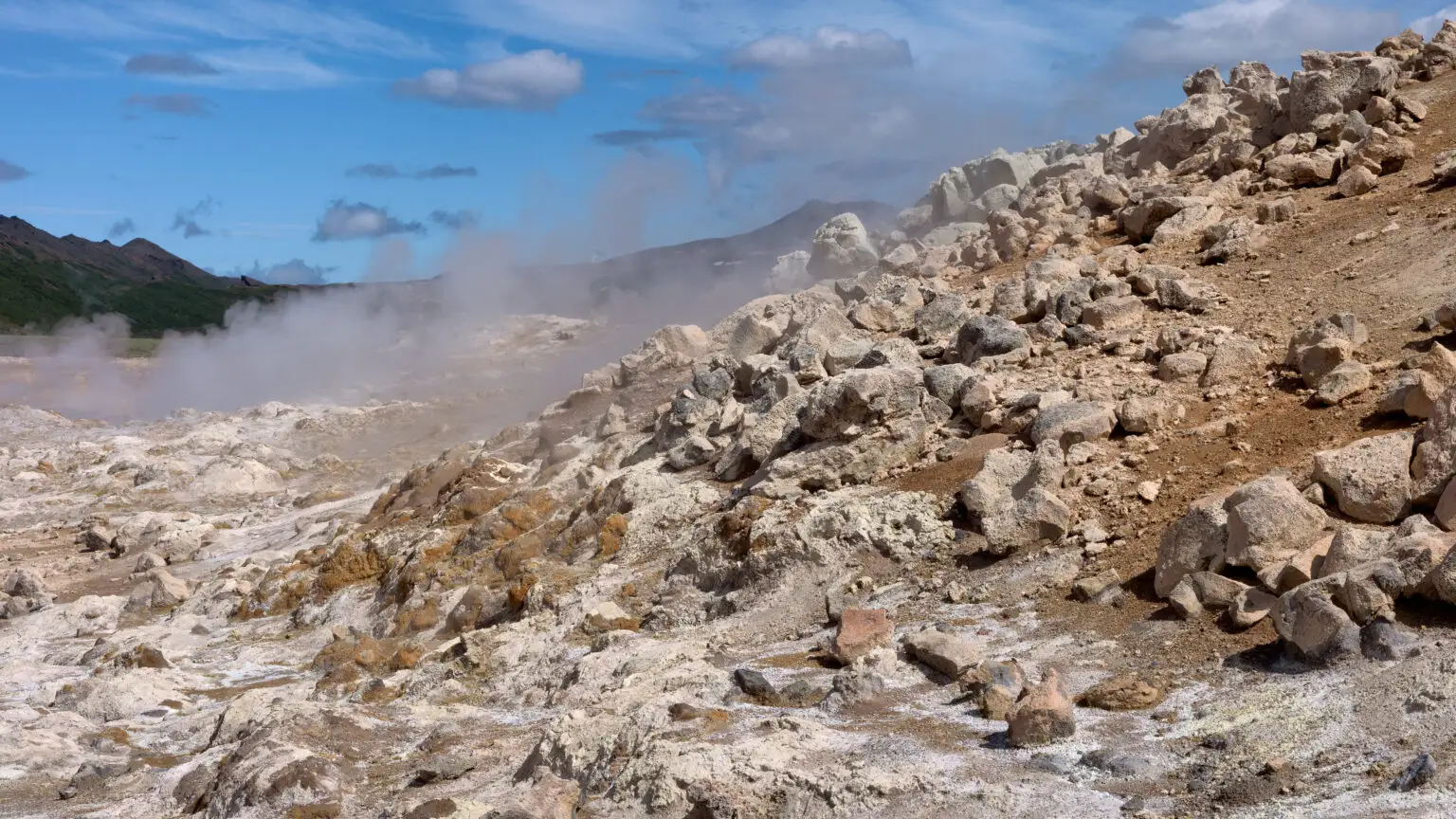
High-resolution RGB captures visual change over time for comparative analysis.
Products
 Sentry OS
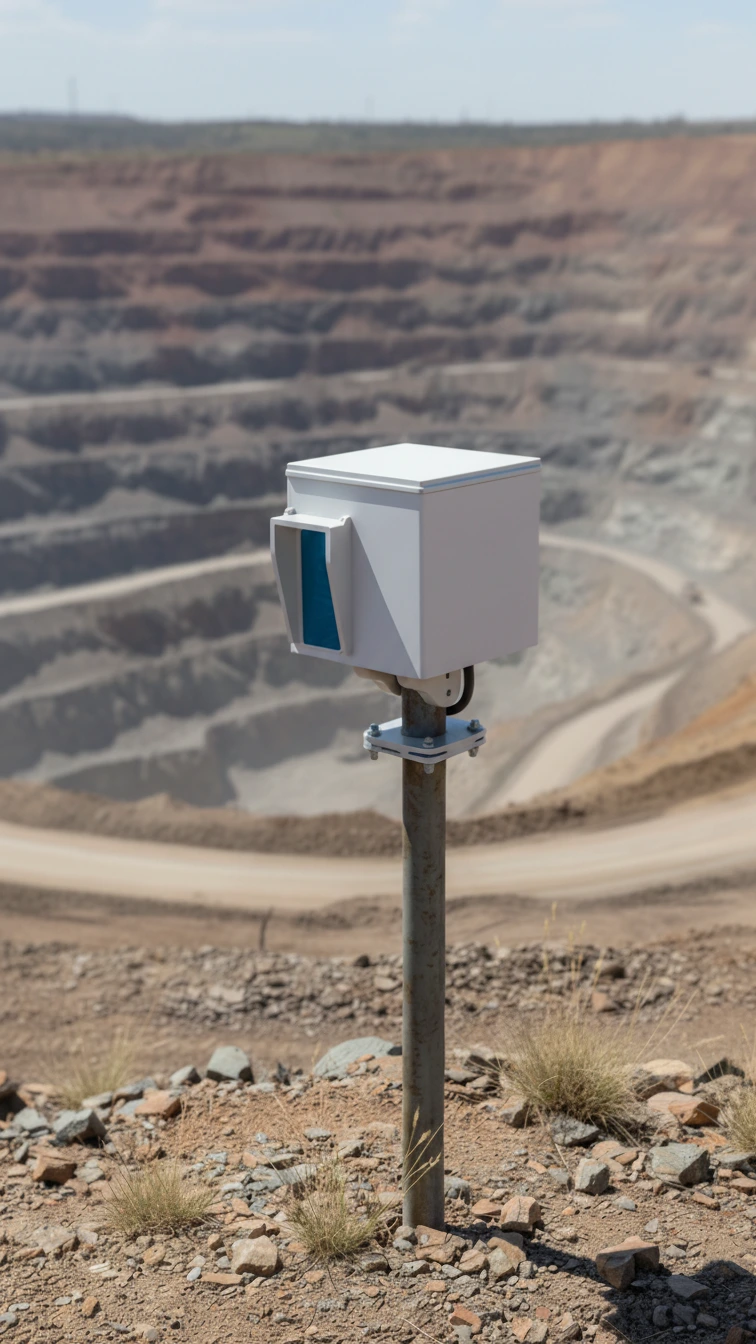
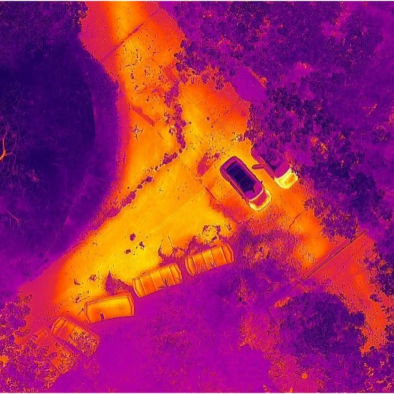
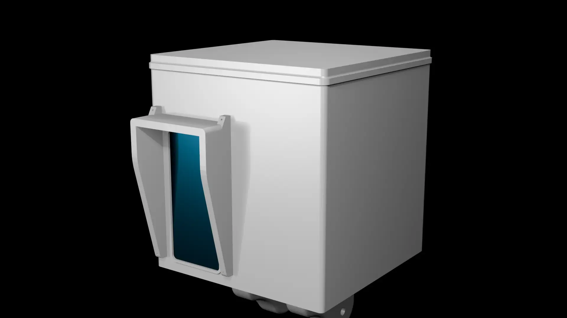
The Terrain Sentry is a constantly scanning stack of sensors housed in a rugged box built to withstand weathering and operational hazards that collects everything there possibly could be to know about the terrain. Through a combination of Optical, Thermal, and LIDAR, a complete visual of the terrain is created that's supplemented with additional data from weather sensors and seismometers.
Vision
High-resolution RGB captures visual change over time for comparative analysis.
Vision
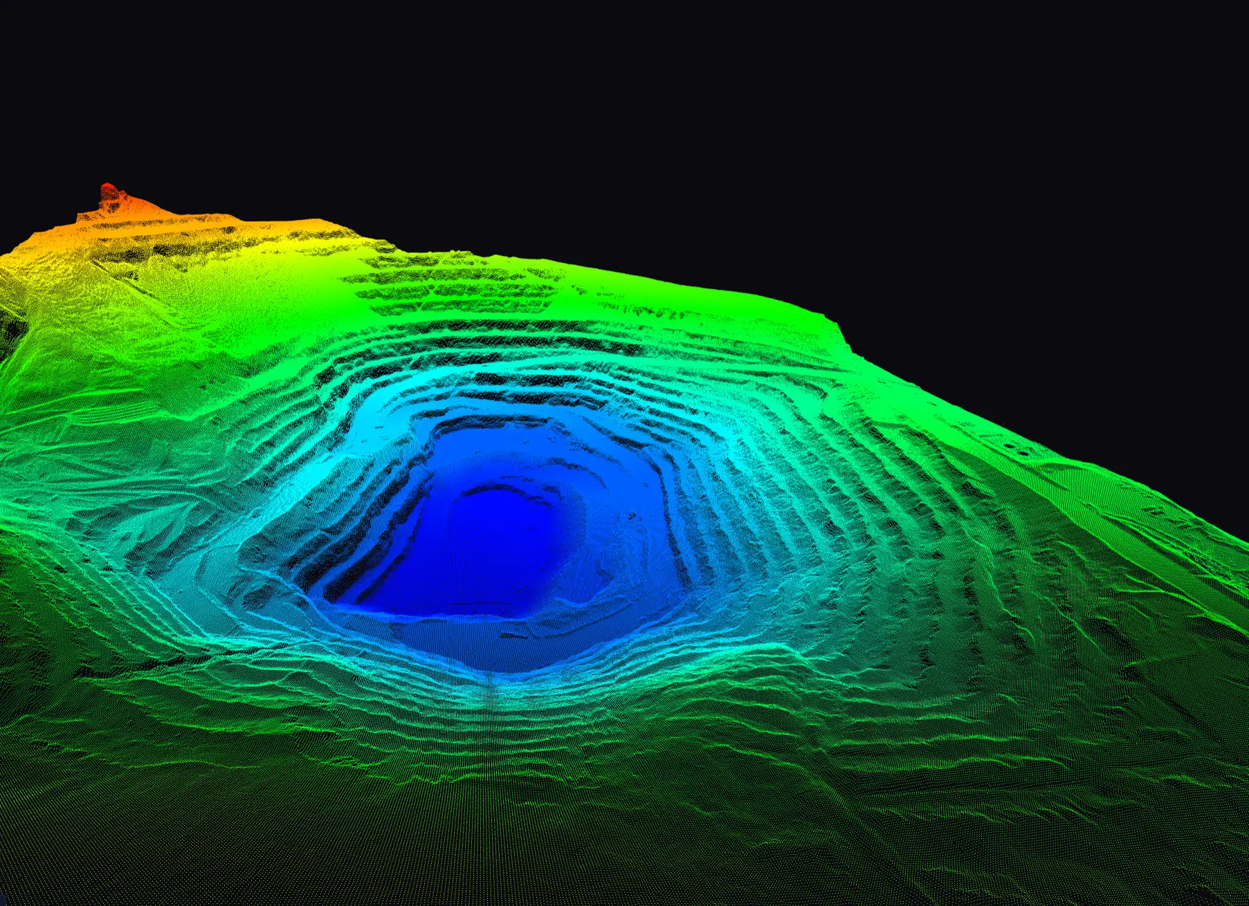
Millimetre-accurate 3D point clouds detect subtle ground movement before it becomes critical.
Vision
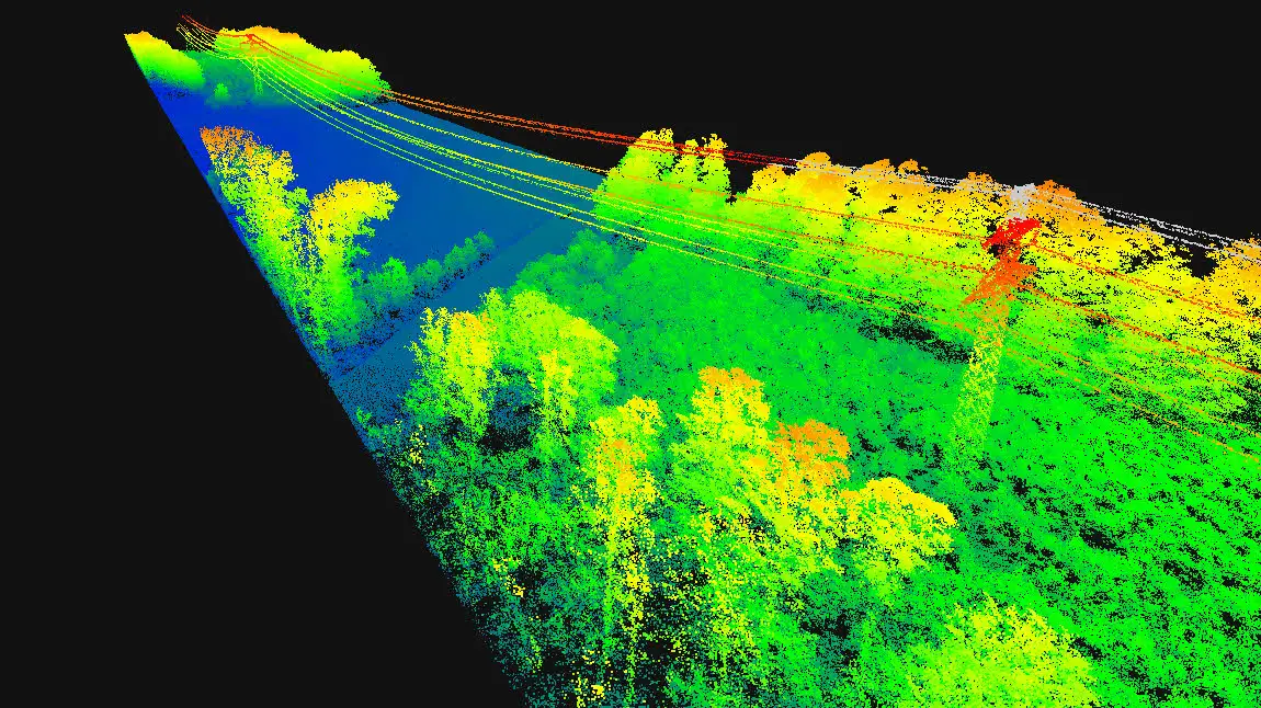
Infrared imaging reveals subsurface heat signatures invisible to the naked eye.
Scanning Uptime
24/7
FOV Of Scans
360°
Scanning Range
300m
1
We come and set up the number of Terrain Sentries needed for your purposes with minimal footprint.
2
Start using Terrain Sentry data readouts in your operation immediately with Sentry OS.
3
We will upgrade and maintain deployments throughout the contract with no additional charge.
Decide if this is right for you with a quick 20 min call.
 Contact Us